Human beings are pretty familiar with the concept of "ice ages." Not only is their ample physical evidence to suggest that glacial periods occurred during the Pleistocene epoch - which lasted from ca. 2.58 million to 11,700 years ago, there are even Indigenous oral traditions that speak of lake formation and dramatic climate shifts in the distant past. Far from being mere myths, these traditions are considered preserved accounts that are corroborated by scientific findings. However, the cycles of glacial and interglacial periods that characterize the Pleistocene were merely the latest in a long line of historical shifts in Earth's climate.
According to the geological record, Earth has experienced multiple ice ages during the past 2.5 billion years, which peaked around 20,000 years ago with average temperatures being 8 °C (14.5 °F) cooler than they are today. Today, scientists are making similar finds on Mars, which also bears the marks of repeated ice ages that shaped the landscape. Like Earth, these climatic shifts were the result of long-term variations in Mars' axial tilt (obliquity), leading to fluctuating temperatures that caused ice flows to advance and retreat across the planet.
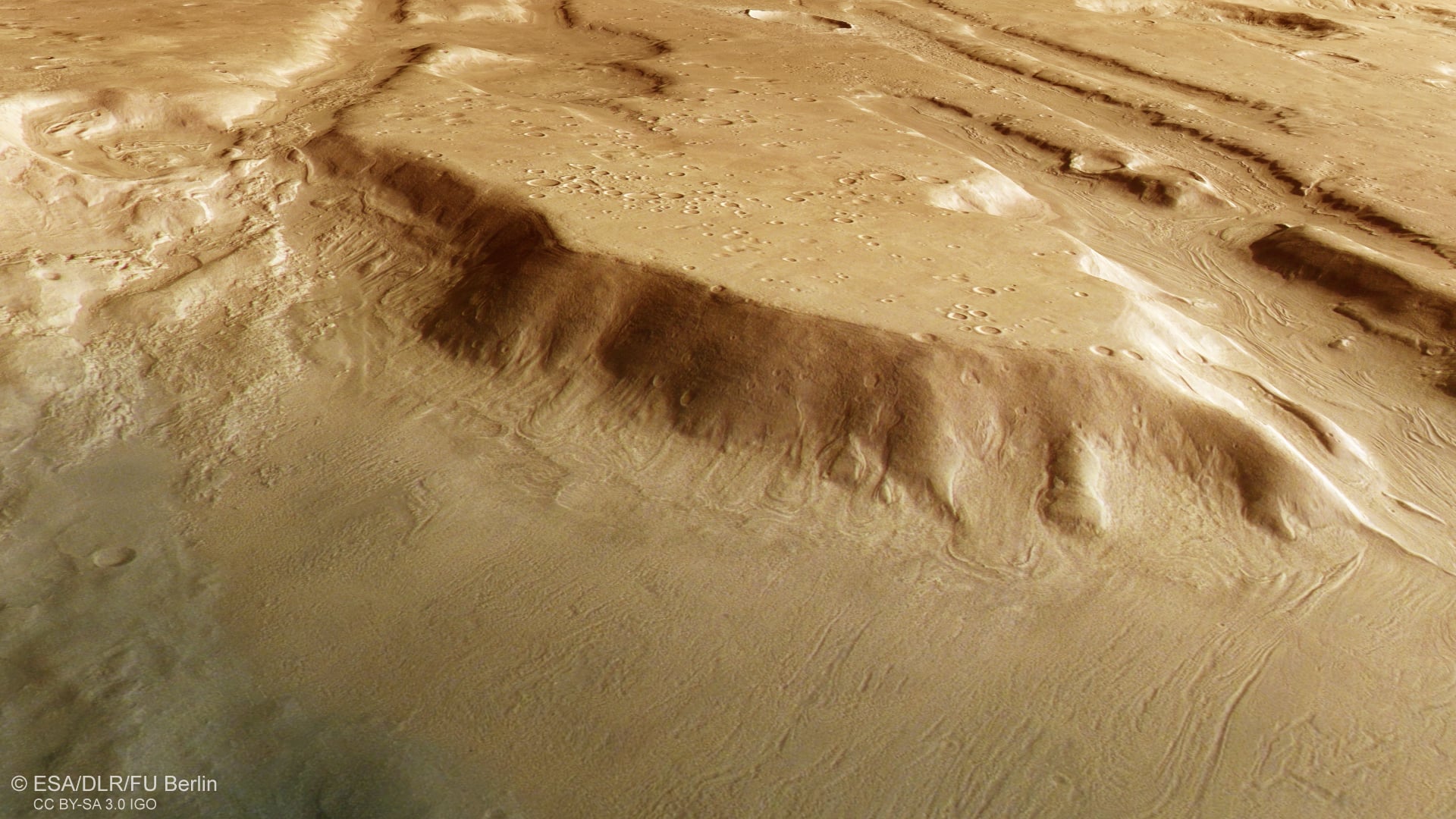
Evidence of these flows has been captured in a new series of images taken by the High Resolution Stereo Camera on the ESA’s Mars Express orbit. The images show a prominent feature known as Coloe Fossae, system of intersecting canyons located in the Ismenius Lacus quadrangle between the Northern Lowlands and the Southern Highlands. On the floors of these canyons (and the many craters that mark the region), there are visible patterns of swirling lines that indicate where material flowed during a previous ice age.
 *View generated from the digital terrain model and the nadir and colour channels of the High Resolution Stereo Camera on ESA’s Mars Express. Credit: ESA/DLR/FU Berlin*
The technical term for these patterns is lineated valley fill (LVF) or concentric crater fill (CCF), which is composed of rocky material deposited by ice flows as they advanced or retreated from an area. Scientists see these patterns on Earth with glaciers, which have left behind what is known as "till" (a combination of clay, silt, sand, and gravel) that form ridges and elongated mounds. However, these features are located in a region that sits far from the ice cap in Mars' northern polar region, indicating that glaciers once covered the region.
Similar to glacial periods on Earth, these glaciers are believed to have advanced from the Martian poles towards the mid-latitudes before retreating again during interglacial periods. Furthermore, scientists have viewed LVF and CCF features all across the mid-latitudes of Mars, suggesting that the entire planet experienced glacial activity in the past. Lastly, there's the fundamental takeaway from these and other observations, which have revealed that Mars experience multiple glacial periods as its atmosphere was slowly being stripped away, causing most of the water on its surface to disappear.
Tracking how ice flowed across the Red Planet is key to reconstructing the geological and environmental history of Mars, from which scientists can deduce how and when it made the transition from a warmer, wetter planet to the extremely cold and dry world we see today.
Click here to see the annotated version of the top image, and click on the circled regions to see the LVF features more closely.
Further Reading: ESA