Since 2001, NASA's Mars Odyssey orbiter has been studying the Martian surface and atmosphere to look for evidence of past or present water and ice, and study the planet's geology and radiation environment. As the longest-running mission to orbit another planet, this robotic probe has taken some impressive images of the Red Planet and its major surface features. In a new panorama, the Mars Odyssey orbiter captured a spectacular view of Arsia Mons, peeking above a dense canopy of clouds just before dawn. This marks the first time one of Mars' volcanoes has been imaged on the planet's horizon.
Arsia Mons is one of three extinct shield volcanoes (the others being Pavonis Mons and Ascraeus Mons) that comprise the Tharsis Montes mountain chain. Arsia is the southernmost of the three, all of which sit atop the Tharsis plateau that formed from volcanic activity during the Noachian period (ca. 4.0 to 3.7 billion years ago). Along with Olympus Mons, which is offset to the northwest of the three, these extinct volcanoes are the largest in the Solar System. Past observations have shown that these mountains are often surrounded by clouds of water ice (rather than the more common carbon dioxide clouds) in the early morning.
The images were captured on May 2nd and are part of a science campaign that began in 2023 when Odyssey started taking high-altitude images of the Martian horizon with its Thermal Emission Imaging System (THEMIS). This camera takes images in visible and infrared light, allowing scientists to identify areas of surface water ice and discern the presence of water in the atmosphere. The latter allows scientists to identify areas of the subsurface that contain water ice, which could be used by the first astronauts to land on Mars.
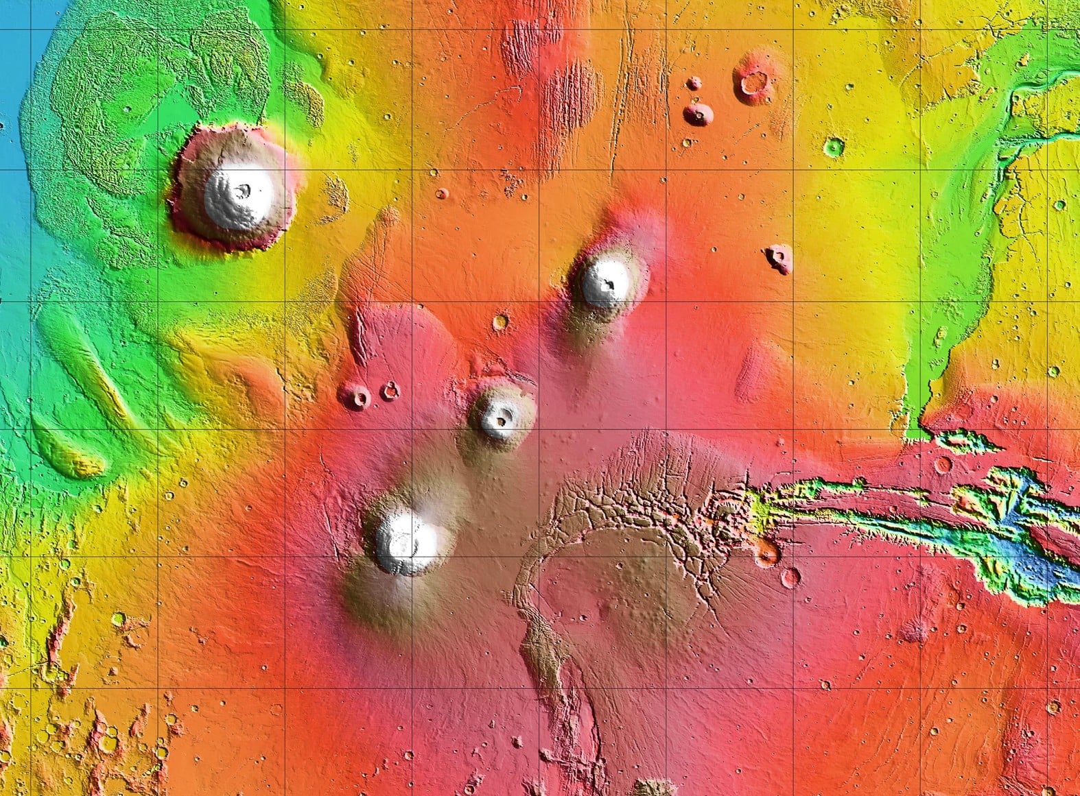 Tharsis Montes, with Olympus Mons (upper left) and Valles Marineris (right). Credit: NASA/JPL-Caltech
To acquire these images, the spacecraft rotates 90 degrees in orbit so scientists can see dust and water ice in the cloud layers and track seasonal changes. The study of Martian clouds is vital to understanding the dynamics that drive Martian weather, including seasonal dust storms. While the images focus on the upper atmosphere, the Mars Odyssey team has also tried to include surface features. “We're seeing some really significant seasonal differences in these horizon images," said Michael D. Smith, a planetary scientist at NASA's Goddard Space Flight Center. "It's giving us new clues to how Mars' atmosphere evolves over time."
The clouds shown in the image form when expanding air travels up the sides of the mountains, rapidly cooling and condensing as it reaches near the apex. In the case of Arsia Mons, the apex is roughly 11.7 km (7.3 mi or 38,386 ft) above the surface, almost twice the height of the tallest volcano on Earth, Nevado Ojos del Salado, which reaches an altitude of 6.89 km (4.28 mi or 22,615 ft). This is especially common when Mars is at its farthest point from the Sun (aka aphelion), leading to cloud patterns forming around the equator that are collectively referred to as the aphelion cloud belt. These early morning clouds are on full display in the image around Arsia Mons, which is known to have particularly dense clouds during these periods.
"We picked Arsia Mons hoping we would see the summit poke above the early morning clouds. And it didn't disappoint," said Jonathon Hill, operations lead for the THEMIS camera. In addition to providing the first glimpse of one of Mars' most famous features as it appears on the horizon, this information could assist future missions to Mars. This includes entry, descent, and landing (EDL) operations, which will be especially important when crewed missions attempt to land there in the coming decades.
Further Reading: NASA